Carolina Amell

(Author)

Illustrated MapsHardcover, 1 January 2020
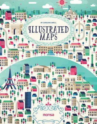
Illustrated Maps
Qty
1
Turbo
Ships in 2 - 3 days
In Stock
Free Delivery
Cash on Delivery
15 Days
Free Returns
Secure Checkout
Buy More, Save More
Print Length
192 pages
Language
English
Publisher
Monsa Publications
Date Published
1 Jan 2020
ISBN-10
8416500266
ISBN-13
9788416500260

Description

This book is a selection of different ways to interpret a map at the illustrative level. Several artists have created maps of the world´s most beautiful places and also its main cities, including Paris, Berlin, Dubai, Rio de Janeiro, and more. They are colorful illustrations in which each artist shows us his or her own way of working with lines and geometrical shapes, some very detailed or synthesized, some using computers or watercolors, and some simply using a pen.

Product Details

Author:
Carolina Amell
Book Format:
Hardcover
Country of Origin:
US
Date Published:
1 January 2020
Dimensions:
23.62 x 18.8 x 1.78 cm
ISBN-10:
8416500266
ISBN-13:
9788416500260
Language:
English
Pages:
192
Weight:
861.82 gm

Need Help?
+971 6 731 0280
support@gzb.ae

About UsContact UsPayment MethodsFAQsShipping PolicyRefund and ReturnTerms of UsePrivacy PolicyCookie Notice

VisaMastercardCash on Delivery

© 2024 White Lion General Trading LLC. All rights reserved.