Collins Maps

(Author)

Collins Children's Picture AtlasHardcover, 1 July 2019
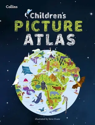
Collins Children's Picture Atlas
Qty
1
Turbo
Ships in 2 - 3 days
In Stock
Free Delivery
Cash on Delivery
15 Days
Free Returns
Secure Checkout
Buy More, Save More
Reading Age
Ages: 8-12
Grade Levels
3-7
Print Length
48 pages
Language
English
Publisher
Collins
Date Published
1 Jul 2019
ISBN-10
0008320322
ISBN-13
9780008320324

Description

A beautifully illustrated picture atlas designed to take children on an exciting journey around the world.

The atlas opens with the continents, then presents a world view of countries before exploring deeper into each country and the exciting places to visit within each.

- The maps are clear, colourful and perfect for children to explore the world and let their imaginations run riot.

- Illustrated by Steve Evans.

- This book is ideal for home or school and finding out more about the world whilst also helping to develop essential reading skills.

- Clear, colourful, highly informative, illustrated mapping designed for young readers.

- Arranged by continent for easy reference.

- Facts about the world we live in are included on each spread.

Product Details

Audience:
Ages: 8-12
Author:
Collins Maps
Book Format:
Hardcover
Country of Origin:
US
Date Published:
1 July 2019
Dimensions:
30.23 x 23.88 x 1.02 cm
Educational Level:
Grade Levels: 3-7
ISBN-10:
0008320322
ISBN-13:
9780008320324
Language:
English
Pages:
48
Publisher:
Weight:
612.35 gm

Need Help?
+971 6 731 0280
support@gzb.ae

About UsContact UsPayment MethodsFAQsShipping PolicyRefund and ReturnTerms of UsePrivacy PolicyCookie Notice

VisaMastercardCash on Delivery

© 2024 White Lion General Trading LLC. All rights reserved.